Satellite Photos From Sudan Have Unveiled Evidence Of Mass Killings Visible From Space
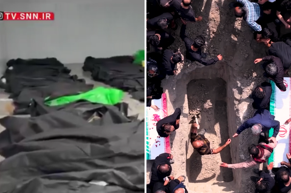
The bloodstains and bodies appear in hospitals, residential areas, and near military bases, suggesting widespread mass killings.

Satellite photos analyzed by Yale’s Humanitarian Research Lab (HRL) have unveiled evidence of mass killings in El Fasher city in Sudan, after the paramilitary militia, the Rapid Support Forces (RSF), took over the city.
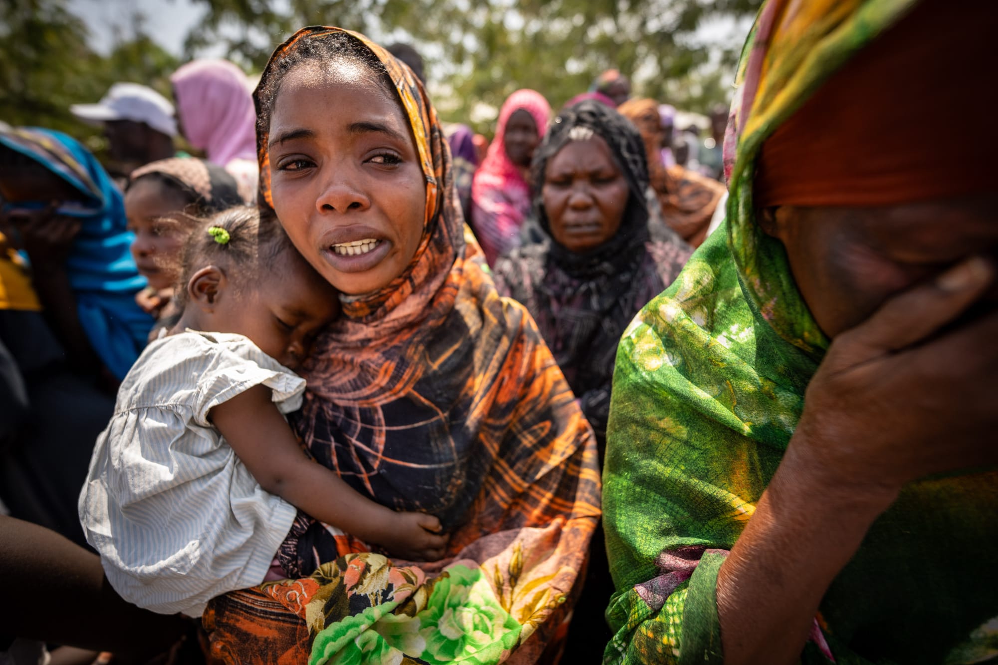
Since 2023, Sudan has been in a brutal war due to a power struggle between the Sudanese military and RSF that has killed up to 150,000 people, including thousands of children.
El Fasher was the Sudanese military’s last stronghold in the Darfur region of western Sudan.
For the past 18 months, RSF has been besieging El Fahser, where more than 250,000 people live, while fighting the Sudanese army, with reports of killings, humiliation, rape and starvation of civilians.
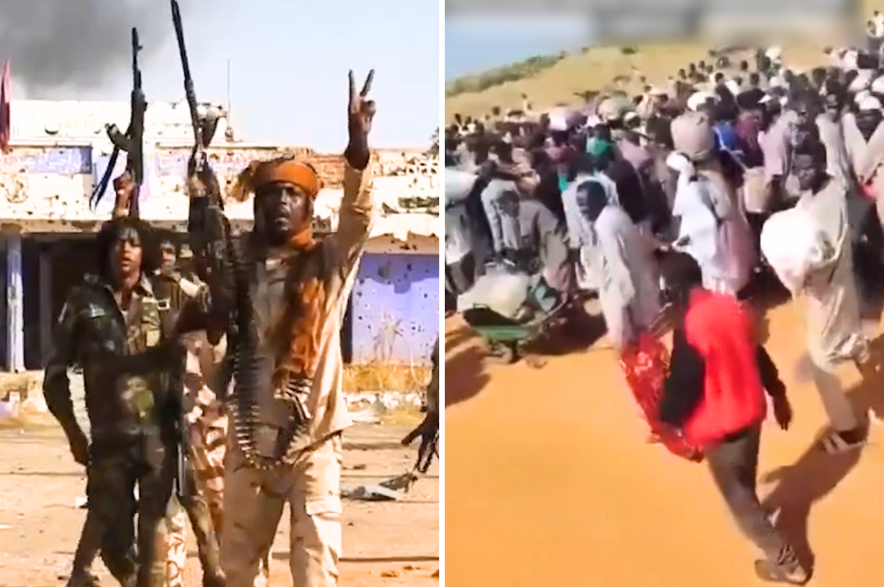
On Oct. 26, RSF captured the army headquarters, specifically the 6th Infantry Division base.
RSF fighters reportedly killed dozens of unarmed civilians with “ethnic motivations” following its take over, with reports of at least 2,000 people killed over the span of two days.
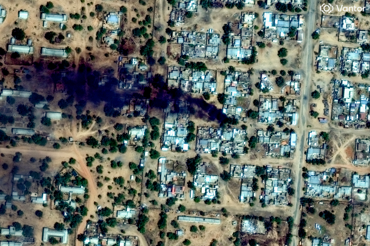
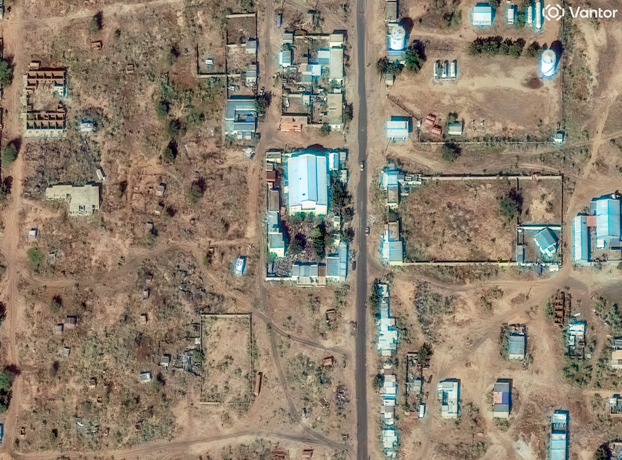
HRL’s report, based on satellite images taken on Monday Oct. 27 and Tuesday Oct. 28, showed photos containing clusters of objects and ground discoloration that it said is believed to be evidence of human bodies.
The numerous clusters and shapes on the ground measure between 1.3 to two meters in length, which match the size and shape of human bodies lying on the ground.
Images showed lines of dark-colored objects consistent with groups of people, and on the next day, a large group of slightly larger dark objects with the same color as those of the previous day, which is consistent with large groups of people being present, subsequently killed, and their bodies showing up on satellite imagery.
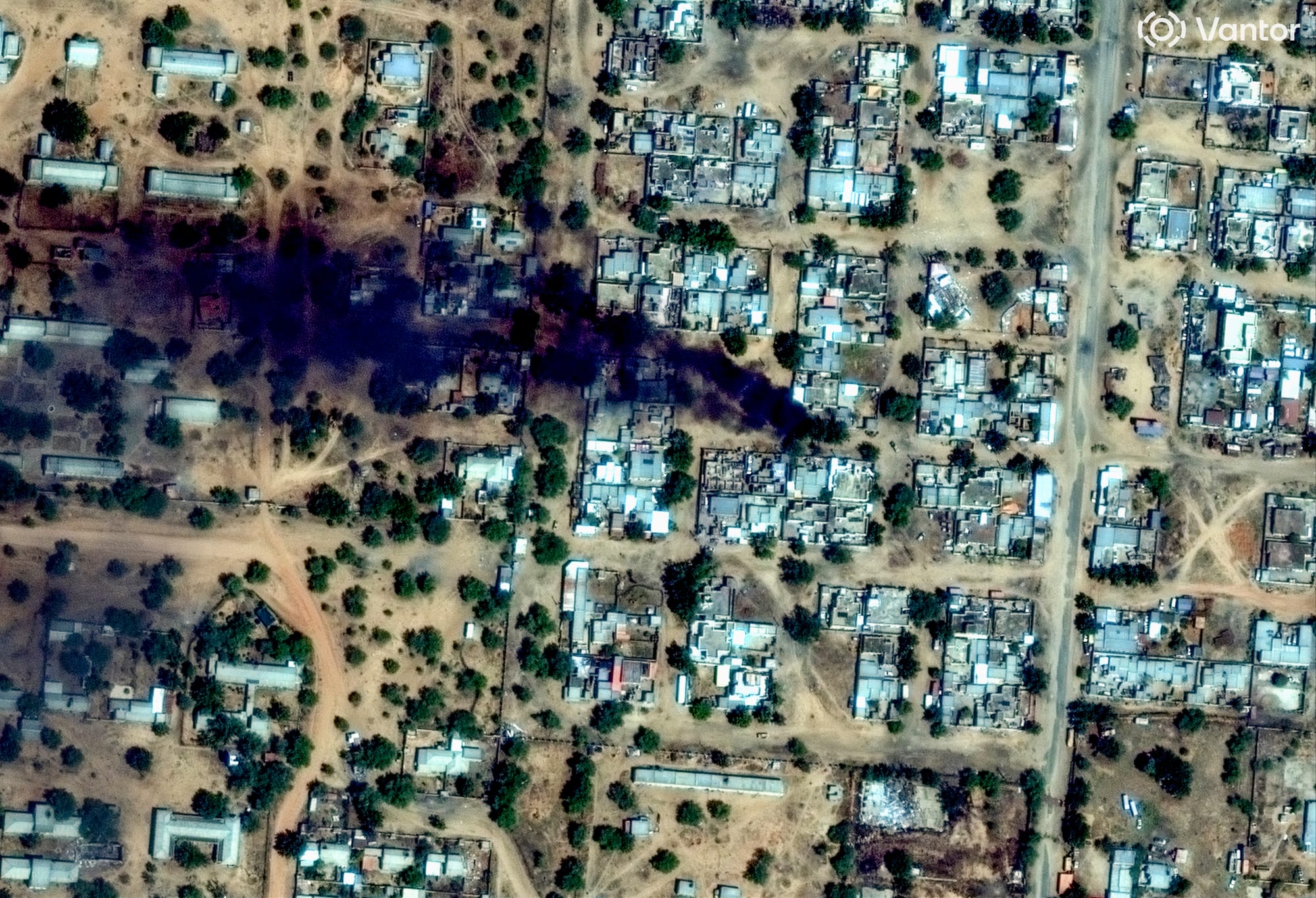
The bloodstains and bodies appear in hospitals, residential areas, and near military bases, suggesting widespread mass killings.
The HRL backed up its findings with accounts from aid groups that reported chaotic scenes on the ground, including killings, arrests and attacks on hospitals.
RSF’s takeover of El Fasher represents a critical shift in control, as it now governs all five state capitals in Darfur, solidifying its dominance over the region.